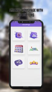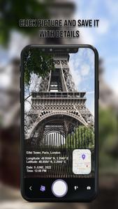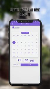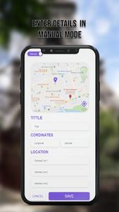


The GPS Map Cam app allows users to geotag their photos with GPS coordinates, date and time stamps, altitude, and weather information. The app also includes a live GPS camera and offline 3D maps for navigation without an internet connection. Users can customize the map format and add their address to their photos. The app can be used to add location stamps to photos for emergency situations and for sharing with friends and family. The app is available on the Play Store and users can provide feedback on its performance.
GPS Map Cam to add GPS Location & date time stamps Geotag PhotosDo you want to capture your memories while driving?
Make your memories with this GPS map camera geotag photos app, add date time, map, latitude and longitude, altitude, and accurate weather, to your gallery photos. To support you we launch a live Gps camera map photos application as a road route viewer easily with a 3d Gps camera. Add GPS coordinates, and date time stamps on Photos with a GPS Map camera for location. Convert your smartphone into the ultimate geotagging solution.GPS map lives Cam: Geotag Photos & add GPS location App trace your current location and weather forecas.....